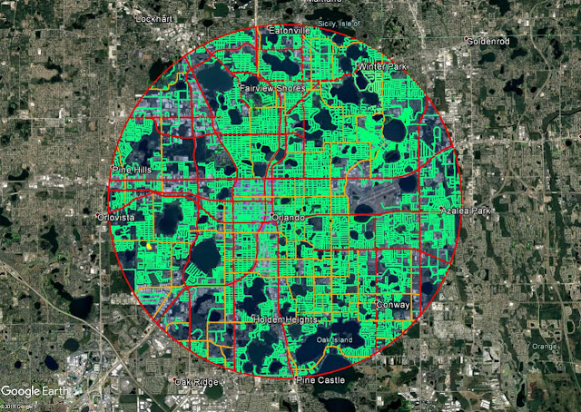
It's been a slog, but I've finally captured every road's center line in Orlando within the 5 mile radius of Lake Eola! With this information, I'll now be able to measure the 5 sections of each road, average them out, and get a total paved area for the residential and local streets.
If you only consider the red and orange lines, which have been previously quantified, it only comes out to 194 miles of total length. But you can see all of the bright green between these highways and arterials, I'd be willing to bet we're looking at well over 1000 miles total!
From this image, you can see that the grids are far more dense and complete on the East side of the city. The west is a little less developed, and has more industrial uses, especially up in the North West quadrant.

Comments
Post a Comment